

Digital palimpsest
Digital palimpsest
Additional image::
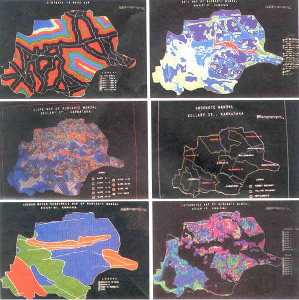
Digital palimpsest: In 1991, the National Remote Sensing Agency, Hyderabad, used GIS to undertake a pilot study for wasteland development in Bellary district of Karnataka. The wastelands were divided into 16 classes based on various parameters. Digitised maps of single parameters, such as distance to roads (top left), soil type (top right), slope (middle left), villages and forests (middle right) and groundwater resources (bottom left) were generated. The various layers of information were then superimposed (bottom right), to generate a composite map with various wasteland types
Publication Date:
30/08/1994
3
19940831
0


