Restrictions are redundant
Restrictions are redundant

India is not alone in restricting access to maps, but is perhaps the only country to have encouraged an irrational regime that guards even basic information. The armed forces of any nation would obviously want to restrict the ability of an adversary to find a position accurately on the ground. Earlier, this was achieved by omitting the scale of the maps; information on latitude and longitude; contours of heights with respect to the mean sea level and other such data.
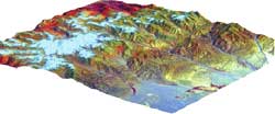
But today, the resolution achievable with remote sensing satellites makes toposheet restrictions redundant. Take the Ikonos satellite, owned by a private company called Space Imaging. It provides imagery of any part of the world at 1 metre by 1 metre resolution


