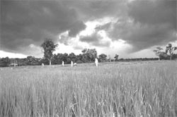
Awaiting the deluge
Awaiting the deluge

as the drought continues to tightens its vise-like grip on the land, killing people and cattle alike, the entire country turns to watching the sky for succor. The fleecy clouds - precusor of the approaching monsoon. This year, Indians have begun their vigil for the arrival of the monsoon earlier than usual.
The normal date for the monsoon to arrive in Sri Lanka and over the islands in the Bay of Bengal is around the last week of May. It reaches the extreme south of the Indian peninsula a week later ie. June 1. The one questions that seems to be on everyone's lips this year is: When will the monsoon commence and how extensive is it likely to be?
As is the case every year, this year, too, its arrival is being observed carefully by the Indian Meterological Department's ( imd ) Pune office. The department has started working on the predictions and will publicly declare the actual date the monsoon is scheduled to hit mainland India and its intensity on May 25. "The monitoring of parameters for this vital Long Range Forecasting ( lrf ) starts every year in January. The information is collected during this period and only towards the end of May can some definite dates be given,' S R Kalsi, deputy director, India Meteorological Department, told Down to Earth . Last year, the country witnessed a normal monsoon ***achieving 96 per cent of the long-term average rainfall of 88 cm. In fact since 1988, the country has had 11 successive normal monsoons. Excessive rainfall was registered in 1988 when 119 per cent was recorded.
When Down To Earth contacted V Thapliyal, deputy director-general of meteorology (weather-forecasting), imd , Pune, he said "the normal date for the monsoon's arrival over Kerala is June 1 and the prevailing weather patterns do not indicate an early onset of monsoon over the southern tip of India.'
"Even 10 per cent variation in rainfall figures can result in a distinct change in monsoon distribution. Less than 90 per cent of the rainfall could result in one-third of the nation experiencing a less than normal monsoon, he added. He said that the onset of the southwest monsoon over Kerala is normally expected on June 1. "But the arrival of the monsoon is not linked to rainfall distribution. So a week's delay in the first showers over Kerala should not be interpreted as ominous,' he said.
As in the previous years, a team of 10 meteorologists has been working on the 16-parametre monsoon-forecasting model where regional and global land-ocean weather indicators from December to May are compiled and analysed. The data for global wind patterns during January-February and JanuaryApril, the Northern Hemisphere temperature and pressure anomalies during the same two periods and the El Nino effect in the current and previous years constitute eight of the 16 important parameters of monsoon forecasting.
However, reports have indicated that pre-monsoon rainfall in the current period (till the week ending April 5) is better than that of the corresponding period last year. The pre-monsoon rainfall period begins from March 1 every year. Out of 35 meteorological sub-divisions in the country, 23 sub-divisions received more rain till date than during the corresponding period last year. Only Jammu and Kashmir, coastal Andhra Pradesh, Telengana, Rayalseema and south interior Karnataka received less rainfall in the current period as compared to the same period last year. The pre-monsoon rainfall was the same as that in the previous year in Orissa, west Rajasthan and north interior Karnataka.
In the current period, the cumulative rainfall was normal to excess in six out of 35 meteorological sub-divisions. There was excess rainfall in Andaman and Nicobar Islands, Arunachal Pradesh, Nagaland, Manipur, Mizoram, Tripura and Lakshwadeep while there was normal rainfall in coastal Kerala and Karnataka.
However, in the current period there was deficient rainfall in Assam, Meghalaya, sub-Himalayan West Bengal, Sikkim, hills of west Uttar Pradesh, Punjab, Himachal Pradesh and Jammu and Kashmir and scanty rainfall in Gangetic West Bengal, Orissa, Bihar plateau, Bihar plains, east Uttar Pradesh ( up ), the plains of west up , Haryana, Chandigarh, Delhi, western and eastern part of Rajasthan and Madhya Pradesh, Central Maharashtra, Marathwada, Vidharbha, coastal Andhra Pradesh, Telengana, Rayalseema, Tamil Nadu, Pondicherry, north interior Karnataka and south interior Karnataka. There was no rain in Gujarat, Daman, Dadra and Nagar Haveli, Saurashtra, Kutch, Diu, Konkan and Goa.
However, U C Mohanty, head of the Centre for Atmospheric Sciences at the Indian Institute of Technology, New Delhi, says that good pre-monsoon rainfall does not indicate anything. "Pre-monsoon rainfall is nothing but thunderstorms caused when the land heats up in the summer and low-pressure zones are formed. It is also during this time that there is a build up of moisture that leads to thunderstorms. This happens in isolated areas and are very localised affairs and continue for one to two hours. But in no way can this be used to predict the intensity of the coming monsoon,' he clarifies.
Not all are expecting a very good monsoon. Scientists at the Bangalore-based Centre for Mathematical Modeling and Computer Simulation, an institute under the Council of Scientific and Industrial Research ( csir) , has predicted low rainfall during the monsoon this year compared to last year, owing to factors like atmospheric and spatial distribution of the weather system. Prashant Goswami, one of the scientists involved in the project said: "This year the overall monsoon rainfall in India will be around 789 mm (31 inches), with an error of 30 to 40 mm, against 840 mm last year. This is lower than the rainfall in 1987, when there was a severe drought.' However, he clarified that there is no connection between the low rainfall and drought. He said, that water management and water resource policies also contribute to drought - low rainfall is not the only reason.
The centre was able to forecast the rainfall based on a neural network model, which is an ***algorithm. The previous years' rainfall data is fed into the system and the forecast for the year is predicted. The method followed by the centre is different from the one used by the met department. The met department uses power regression, which involves some parameters like sea surface temperature, snowfall, atmospheric pressure and hemispheric temperature. The met department accumulates the data only by the end of May. So it takes some time for them to predict rainfall for the year,' he said.
Goswami added that drought hit regions are hoping for some relief from the southwest monsoon rain, due to hit the subcontinent in early June, adding that the centre had found that overall monsoon rain would be good in July and August and poor in September. "There will be poor rainfall in September which will account for the poor performance of the monsoon overall,' he added.
R R Kelkar, director-general, imd , while refusing to divulge any information about the upcoming monsoon, said that the revelation by csir is debatable because they had earlier clarified that their model is not for operational use but for experiments only.
How accurate is our weather forecasting?
Towards the end of the 19th century, India was the first country to start systematic development of lrf techniques for estimating the monsoon (June-September) rainfall over India. The first operational lrf for monsoon rainfall over the country as a whole was issued on June 4, 1886, based on antecedent Himalayan snow cover which showed an inverse relationship with the subsequent monsoon rainfall over India and Burma. Since then efforts have continued to develop LRF models. Over the past 80 years, several improvements were affected in LRF techniques.
"The accuracy of weather forecasting decreases with duration. The shorter the duration, the chances of accuracy is more. But we should understand that there are many processes at work because the atmosphere is an open lab. In India we use the statistical method of prediction (using five years record) where as, I feel, we should use the dynamical method which is based on the laws of physics. Statistical forecasting will work if we have a lot of data. This method is used in advanced countries because the more data you get, the more accurate will be your forecasting,' says Mohanty.
"In the case of Indian summer monsoon rainfall, reliable data regarding parameters which influence rainfall is available for the past 40 years only. Hence the use of a 16-parameter model will not be considered reliable by most statisticians,' says J Srinivasan, chairman of the Centre for Atmospheric and Oceanic Sciences, Indian Institute of Science, Bangalore.
Mohanty adds that the imd has been accurate in the last 11 years but should try to give sector-wise, region-wise and even month-wise forecasts. Instead of notifying the final dates in May, they can also release the status in the preceding months. This, he says, will help the people to take precautionary measures and also prepare them psychologically to counter any uncertainty. He suggests that instead of using ambiguous words, the imd should use more specific terms like giving probability percentages like they do in the West, "since we are more dependent on accurate weather information.'
However, Kelkar says that the 16-parameter model has proved reliable so far and the imd will continue using it. V Thapliyal, deputy-director general of meterology (weather forecasting), imd , Pune agrees. He says, " imd uses the 16-parameter model to issue monsoon rainfall forecasts. However, under imd 's research and development programme, different kinds of forecast models are developed and tested to be used operationally.'


